 Lýsigagnagátt
Hæð
Type of resources
Available actions
Topics
INSPIRE themes
Keywords
Contact for the resource
Provided by
Formats
Representation types
Update frequencies
Scale
-

IS: Í korstjánni er hægt að skoða hæðarlíkan af Íslandi og hlaða því niður. en: The Digital Elevation Model (DEM) Map from Landmælingar Íslands allows to view and download the DEM, find its derivative like slope and orientation and much more. ÍslandsDEM refers to "Digital Elevation Model (DEM) of Iceland" in English. A DEM is a digital representation of the Earth's surface topography, typically represented as a grid of elevation values. It provides information about the height or elevation of the terrain across a specific area, allowing for the creation of detailed three-dimensional representations of the landscape. DEM data is widely used in various applications, including geographic information systems (GIS), environmental modeling, land use planning, engineering design, and natural resource management. It can be used to analyze terrain characteristics, calculate slope and aspect, identify drainage patterns, model water flow, and assess landscape suitability for various purposes.
-
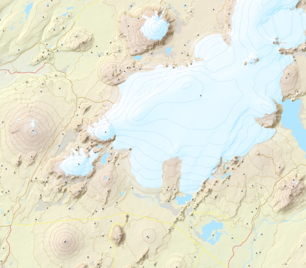
Hæðargögnin innhalda bæði línu- og punktalag.Í laginu is50v_haedarlinur eru sýndar hæðarlínur 20 metra og 100 metra hæðarlínur. Á fáeinum stöðum er að finna viðbótar 10 metra hæðarlínur.