 Lýsigagnagátt
Boundaries
Type of resources
Available actions
Topics
INSPIRE themes
Keywords
Contact for the resource
Provided by
Years
Formats
Representation types
Update frequencies
status
Scale
Resolution
-

Riparian zones represent transitional areas occurring between land and freshwater ecosystems, characterised by distinctive hydrology, soil and biotic conditions and strongly influenced by the stream water. They provide a wide range of riparian functions (e.g. chemical filtration, flood control, bank stabilization, aquatic life and riparian wildlife support, etc.) and ecosystem services. The Riparian Zones products support the objectives of several European legal acts and policy initiatives, such as the EU Biodiversity Strategy to 2020, the Habitats and Birds Directives and the Water Framework Directive. Green Linear Elements (GLE) are ecologically significant, structural landscape elements which act as important dispersion vectors of biodiversity. GLEs comprise hedgerows and lines of trees and offer a wide range of ecosystem services: they are linked to both landscape richness and fragmentation of habitats, with a direct potential for restoration, and contribute also to hazard protection. Green linear elements form part of the Green Infrastructure and are specifically addressed in the EU Biodiversity Strategy 2020. The GLE product provides reliable and detailed geospatial information on the occurrence and spatial distribution of: Small linear vegetation features such as hedgerows, scrub and tree rows with a minimum length of 100m and a width of up to 10m; Isolated patches of trees and scrub with a size between 500 m² and 0.5 ha. Green linear elements including trees and hedgerows with 100m minimum length and 500 m² Minimum Mapping Unit (MMU)
-

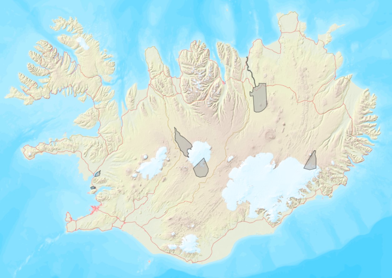
Boundaries of various areas within Vatnajökull National Park with special rules. 1. Esjufjöll, Jökulsárgljúfur, Skaftafell and Askja have special rules about camping restrictions, according to article 3, in regulation about Vatnajökull National Park, 300/2020. Coordinates are listed in table 2 in amendment IV in the regulation. 2. Hvannadalshnjúkur, Öræfajökull and Kverkfjöll have special limitations on, if and when motorized traffic is allowed. 3. Traditional land use areas are listed in article 26 of regulation about Vatnajökull National Park, 300/2020. Disclaimer: If there is a difference between the data and the regulation text, then the regulation text applies.
-

This data includes all defined hiking trails within Vatnajökull National Park, and selected trails near the park. The trails are drawn from hiking maps that the park has published since it was founded in 2008. The maps have been updated regularly since, last update was in 2019, (Snæfell area and a large part of the western region). These hiking maps can be viewed by selecting “Hiking map, click on frame” in the Vatnajökull National Park Mapview, (see link below).
-
Ramsarsvæði eru votlendissvæði í heiminum sem njóta sérstakrar verndar.
-

Umsóknin um Þingvelli á heimsminjaskrá var lögð fram í febrúar 2003 og var hún samþykkt á fundi heimsminjanefndar UNESCO í júlí 2004. Þingvellir eru þjóðgarður sem var með lögum stofnaður árið 1930.
-

Eftirfarandi landshlutar eru sóttvarnaumdæmi, sbr. reglugerð 387/2015: Höfuðborgarsvæðið (Reykjavíkurborg, Seltjarnarnesbær, Kópavogsbær, Garðabær, Hafnarfjarðarkaupstaður, Mosfellsbær, Kjósarhreppur og fyrrum sveitarfélagið Þingvallasveit). Vesturland (Akraneskaupstaður, Hvalfjarðarsveit, Skorradalshreppur, Borgarbyggð, Eyja- og Miklaholtshreppur, Snæfellsbær, Grundarfjarðarbær, Helgafellssveit, Stykkishólmsbær, Dalabyggð, Reykhólahreppur, Strandabyggð, Kaldrananeshreppur, Árneshreppur og Húnaþing vestra). Vestfirðir (Vesturbyggð, Tálknafjarðarhreppur, Ísafjarðarbær, Bolungarvíkurkaupstaður og Súðavíkurhreppur). Norðurland (Húnavatnshreppur, Blönduósbær, Skagabyggð, Sveitarfélagið Skagaströnd, Sveitarfélagið Skagafjörður, Akrahreppur, Fjallabyggð, Dalvíkurbyggð, Hörgársveit, Eyjafjarðarsveit, Akureyrarkaupstaður, Svalbarðsstrandarhreppur, Grýtubakkahreppur, Þingeyjarsveit, Norðurþing, Tjörneshreppur, Skútustaðahreppur, Svalbarðshreppur og Langanesbyggð að frátöldum fyrrum Skeggjastaðahreppi). Austurland (Vopnafjarðarhreppur, Fljótsdalshérað, Fljótsdalshreppur, Borgarfjarðarhreppur, Seyðisfjarðarkaupstaður, Fjarðabyggð, Breiðdalshreppur, Djúpavogshreppur og fyrrum Skeggjastaðahreppur). Suðurland (Sveitarfélagið Ölfus, Hveragerðisbær, Grímsnes- og Grafningshreppur, Bláskógabyggð að frátöldu fyrrum sveitarfélaginu Þingvallasveit, Hrunamannahreppur, Sveitarfélagið Árborg, Flóahreppur, Ásahreppur, Skeiða- og Gnúpverjahreppur, Rangárþing ytra, Rangárþing eystra, Mýrdalshreppur, Skaftárhreppur, Sveitarfélagið Hornafjörður og Vestmannaeyjabær). Suðurnes (Sandgerðisbær, Sveitarfélagið Garður, Reykjanesbær, Grindavíkurbær og Sveitarfélagið Vogar).
-

Landinu skal skipt upp í eftirfarandi heilbrigðisumdæmi, sbr. reglugerð 387/2015: Heilbrigðisumdæmi höfuðborgarsvæðisins. Heilbrigðisumdæmi Vesturlands. Heilbrigðisumdæmi Vestfjarða. Heilbrigðisumdæmi Norðurlands. Heilbrigðisumdæmi Austurlands. Heilbrigðisumdæmi Suðurlands. Heilbrigðisumdæmi Suðurnesja. Í heilbrigðisumdæmum landsins starfa eftirfarandi heilbrigðisstofnanir: Heilsugæsla höfuðborgarsvæðisins, innan heilbrigðisumdæmis höfuðborgarsvæðisins. Heilbrigðisstofnun Vesturlands, innan heilbrigðisumdæmis Vesturlands. Heilbrigðisstofnun Vestfjarða, innan heilbrigðisumdæmis Vestfjarða. Heilbrigðisstofnun Norðurlands, innan heilbrigðisumdæmis Norðurlands. Heilbrigðisstofnun Austurlands, innan heilbrigðisumdæmis Austurlands. Heilbrigðisstofnun Suðurlands, innan heilbrigðisumdæmis Suðurlands. Heilbrigðisstofnun Suðurnesja, innan heilbrigðisumdæmis Suðurnesja.
-
Í markalaginu eru ýmis mörk lands og eru þetta allt flákalög og þau sýna eftirfarandi: skiptingu landsins eftir sveitarfélögum, skiptingu landsins eftir umdæmi sýslumanna, lögregluumdæmi og skiptingu landsins í dómstóla í héraði.
-

IS: Í Kortasjá Náttúrufræðistofnunar er meðal annars hægt að velja kort með örnefnum, loftmyndir, atlaskort eða AMS kort. Þá er þar að finna sveitarfélagakort með upplýsingum um stærð sveitarfélaga og íbúarfjölda, þekju með CORINE landflokkun sem sýnir til dæmis mólendi eða mýrlendi og gamlar ljósmyndir danskra landmælingamanna sem og gamlar bæjarteikningar. EN: Kortasjá from Institute of Nature Research is a simple and reactive map where the user can view placenames, protected areas, Corine classification, roads, height points, buildings, boundaries of municipalities, and more.
-
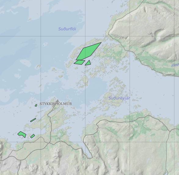
Ræktunarsvæði er afmarkað svæði sjávar nægjanlega stórt til að rúma þann ræktunarbúnað sem notaður er á viðkomandi svæði. Yfirleitt er um að ræða línur sem strekktar eru á milli flot bauja eða sérstaka ræktunarfleka með lóðréttar ræktunarlínur fáeina metra niður undir yfirborð sjávar . Svæðið er merkt með löglegum sjómerkjum þannig að sjófarendur eiga að geta varast þau, enda einnig merkt inn sjókort Landhelgisgæslunnar. Einungis er ræktuð Bláskel (Kræklingur).