 Lýsigagnagátt
50000
Type of resources
Available actions
Topics
INSPIRE themes
Keywords
Contact for the resource
Provided by
Years
Formats
Representation types
Update frequencies
status
Scale
-
Ræktunarsvæði er afmarkað svæði sjávar nægjanlega stórt til að rúma þann ræktunarbúnað sem notaður er á viðkomandi svæði. Yfirleitt er um að ræða línur sem strekktar eru á milli flot bauja eða sérstaka ræktunarfleka með lóðréttar ræktunarlínur fáeina metra niður undir yfirborð sjávar . Svæðið er merkt með löglegum sjómerkjum þannig að sjófarendur eiga að geta varast þau, enda einnig merkt inn sjókort Landhelgisgæslunnar. Einungis er ræktuð Bláskel (Kræklingur).
-

Boundaries of various areas within Vatnajökull National Park with special rules. 1. Esjufjöll, Jökulsárgljúfur, Skaftafell and Askja have special rules about camping restrictions, according to article 3, in regulation about Vatnajökull National Park, 300/2020. Coordinates are listed in table 2 in amendment IV in the regulation. 2. Hvannadalshnjúkur, Öræfajökull and Kverkfjöll have special limitations on, if and when motorized traffic is allowed. 3. Traditional land use areas are listed in article 26 of regulation about Vatnajökull National Park, 300/2020. Disclaimer: If there is a difference between the data and the regulation text, then the regulation text applies.
-
Kortlagning beitarlanda sauðfjár á Íslandi. Landupplýsingaþekjan fyrir beitarlönd sauðfjár er á vektorformi. Nákvæmni gagna miðast við mælikvarða 1:100.000. Frekari upplýsingar um aðferðafræðina á bak við kortlagningu beitarlanda sauðfjár má sjá í ritinu: : Jóhann Helgi Stefánsson, Sigríður Þorvaldsdóttir, Iðunn Hauksdóttir, Elín Fjóla Þórarinsdóttir, Bryndís Marteinsdóttir og Sigmundur Helgi Brink, 2020. Kortlagning beitarlanda sauðfjár á Íslandi. Rit Landgræðslunnar nr. 4. Gunnarsholt, Ísland. https://grolind.is/wp-content/uploads/2020/06/Kortlagning-beitilanda-2020.pdf Landgræðslan og Skógræktin voru sameinaðar 1. janúar 2024 og ber stofnunin heitið Land og skógur.
-

Svæða-, staðar- og farvegaskipting fyrir ofanflóð í samræmi við ofanflóðaskráningarkerfi Veðurstofu Íslands. Um er að ræða stigskiptingu (hierarchy) þar sem landinu er skipt niður í staði, hverjum stað svo niður í svæði og innan svæða eru svo afmarkaðir algengir farvegir ofanflóða.
-
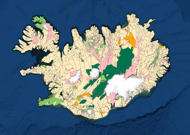
Í markalaginu eru ýmis mörk lands og eru þetta allt flákalög og þau sýna eftirfarandi: skiptingu landsins eftir sveitarfélögum, skiptingu landsins eftir umdæmi sýslumanna, lögregluumdæmi og skiptingu landsins í dómstóla í héraði.
-

Gögnin sýna mörk þéttbýlisstaða samkvæmt skilgreiningu Hagstofunnar.
-
EN: Boundary of Icelandic River Basin Sub unit(s) as reported to WISE on 22.12.2018. A "Sub unit" is a defined area that includes one or more catchments. For international reporting purposes only one Sub unit is used (ID: IS100) which covers the same area as the Icelandic River Basin District. For national management and reporting purposes there are four Sub Units (ID's: IS101, IS102, IS103, IS104). For further description of dataset fields and field values see GML schema here: http://dd.eionet.europa.eu/schemas/WFD2016/GML_SubUnit_2016.xsd IS: Afmörkun íslenskra vatnasvæða miðað við skil inn í WISE upplýsingakerfið þann 22.12.2018. "Vatnasvæði" er landsvæði með einu eða fleiri vatnasviðum. Vegna skýrslugjafar til Evrópusambandsins er aðeins eitt vatnasvæði notað (ID:IS100) sem nær yfir sama svæði og Vatnaumdæmi Íslands. Vegna innlendrar stjórnunar og skýrslugjafar eru fjögur vatnasvæði notuð (IDs: IS101, IS102, IS103, IS104). Nánari lýsing á eigindum og gildum gagnasettsins má finna í GML skema hér: http://dd.eionet.europa.eu/schemas/WFD2016/GML_SubUnit_2016.xsd
-
Ýmsar tölulegar upplýsingar úr manntali Hagstofunnar frá 2011, settar fram á smásvæðaskiptingu Hagstofunnar. Vinsamlega hafið samband við Hagstofuna vegna nánari upplýsinga.
-

Strandlínulagið inniheldur bæði línu- og flákalag og er strandlína landsins sýnd auk eyja og skerja.Í fitjuklasanum is50v_strandlina_linur er strandlína landsins, eyja og skerja sýnd. Hægt er að sjá hvort línan tilheyrir eyjum eða skerjum. Í laginu is50v_strandlina_flakar er strandlína landsins, eyja og skerjar sýnd.
-

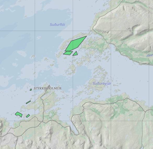
Eldissvæði er svæði sem úthlutað er rekstarleyfishafa. Rekstrarleyfishafi hefur þá heimild til að hafa eldisbúnað til að ala fisk innan þess svæðis skv. skilyrðum rekstrarleyfisins.