 Lýsigagnagátt
100000
Type of resources
Available actions
Topics
INSPIRE themes
Keywords
Contact for the resource
Provided by
Years
Formats
Representation types
Update frequencies
status
Scale
-

Corine Land Cover (CLC) 2018 and CLC change 2012-2018 are two of the datasets produced within the frame of the Initial Operations of the Copernicus programme (the European Earth monitoring programme previously known as GMES) on land monitoring.Corine Land Cover (CLC) provides consistent information on land cover and land cover changes across Europe. This inventory was initiated in 1985 (reference year 1990) and established a time series of land cover information with updates in 2000, 2006. 2012 and now 2018. CLC products are based on photointerpretation of satellite images by national teams of participating countries - the EEA member and cooperating countries – following a standard methodology and nomenclature with the following base parameters: 44 classes in the hierarchical three level Corine nomenclature; minimum mapping unit (MMU) for status layers is 25 hectares; minimum width of linear elements is 100 metres; minimum mapping unit (MMU) for Land Cover Changes (LCC) for the change layers is 5 hectares. The resulting national land cover inventories are further integrated into a seamless land cover map of Europe. Land cover and land use (LCLU) information is important not only for land change research, but also more broadly for the monitoring of environmental change, policy support, the creation of environmental indicators and reporting. CLC datasets provide important datasets supporting the implementation of key priority areas of the Environment Action Programmes of the European Union as protecting ecosystems, halting the loss of biological diversity, tracking the impacts of climate change, assessing development in agriculture and implementing the EU Water Framework Directive, among others. More about the Corine Land Cover (CLC) and Copernicus land monitoring data in general can be found at http://land.copernicus.eu/
-
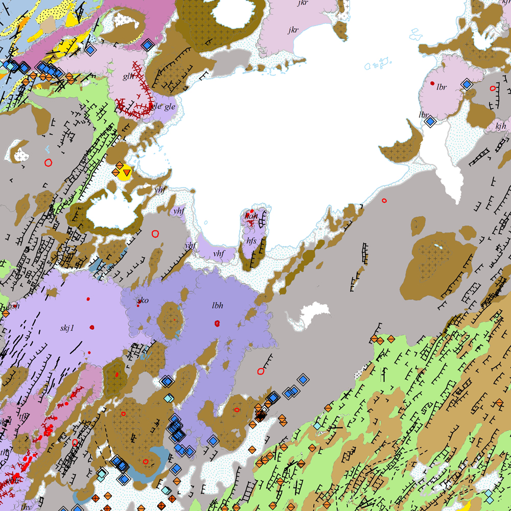
Gagnasafn [GDB] NI_J100v_Vesturgosbelt_1.utg: Jarðfræðikort af Vesturgosbelti Íslands í mælikvarði 1:100.00, 1. útg. [Geological map of the Western Volcanic Zone of Iceland in the scale of 1:100.000, 1st ed.] Kortið sýnir jarðlög, gíga, höggun, strik og halla, framhlaup og niðurföll, steingervinga, jökulrákir, jökulgarða, jökulkembur, malarása og fornar strandlínur stöðuvatna. Jarðlög eru flokkuð eftir aldri, gerð og samsetningu. Kortið var unnin í samstarfi Náttúrufræðistofnunar Íslands og Íslensku Orkurannsoknastofa. Tilvísun: Birgir V. Óskarsson, Ögmundur Erlendsson, Robert A. Askew, Árni Hjartarson, Magnús Á. Sigurgeirsson, Skafti Brynjólfsson og Sveinn Jakobsson 2022. Jarðfræðikort af Vesturgosbelti. 1.100.000. 1. útg. Garðabær: Náttúrufræðistofnun Íslands, Íslenskar Orkurannsóknir og Umhverfis- og Auðlindaráðuneytið. [The map displays bedrock geology, volcanic craters, tectonics, strike and dips, landslides and collapse pits, fossils, glacial striations, glacial moraines, flutes, eskers and ancient lake strandlines. Bedrock is classified by age, type, and composition. The map was completed in a collaborative project between the Icelandic Institute of Natural History and the Icelandic Geosurvey. Bibliographic reference: Birgir V. Óskarsson, Ögmundur Erlendsson, Robert A. Askew, Árni Hjartarson, Magnús Á. Sigurgeirsson, Skafti Brynjólfsson og Sveinn Jakobsson 2022. Geological map of the Western Volcanic Zone, Iceland. 1:100.000. 1st edition. Garðabær: Icelandic Institute of Natural History, Iceland GeoSurvey and Ministry for the Environment and Natural Resources.]
-

The Corine Land Cover datasets CLC2000, CLC2006and CLC change 2000-2006areproduced within the frame of the GMES land monitoringproject.Corine Land Cover (CLC) provides consistent information on land cover and land cover changes across Europe. This inventory was initiated in 1985 (reference year 1990) and established a time series of land cover information with updates in 2000 and 2006.CLC products are based on photointerpretation of satellite images by national teams of participating countries - the EEA member and cooperating countries – following a standard methodology and nomenclature with the following base parameters: 44 classes in the hierarchical three level Corine nomenclature; minimum mapping unit (MMU) for status layers is 25 hectares; minimum width of linear elements is 100 metres; minimum mapping unit (MMU) for Land Cover Changes (LCC) for the change layers is 5 hectares. The resulting national land cover inventories are further integrated into a seamless land cover map of Europe.Land cover and land use (LCLU) information is important not only for land change research, but also more broadly for the monitoring of environmental change, policy support, the creation of environmental indicators and reporting. CLC datasets provide important datasets supporting the implementation of key priority areas of the Environment Action Programmes of the European Union as protecting ecosystems, halting the loss of biological diversity, tracking the impacts of climate change, assessing developments in agriculture and implementing the EU Water Framework Directive, among others.More about the Corine Land Cover (CLC) and Copernicus land monitoring data in general can be found at http://land.copernicus.eu/.
-

Gögnin voru tekin saman í byrjun árs 2015. Þau eru sett saman úr dýptarlínum úr sjókortum í tveimur mælikvörðum. Annars vegar í 1:100.000 og hins vegar í 1:300.000. Dýptarlínur í sjókortum eru ekki með jöfnu bili. Dýptarlínurnar eru þessar: 10 m, 20 m, 50 m, 75 m, 100 m, 150 m, 200 m, 300 m, 400 m, 500 m, 1000 m, 1500 m og 2000 m. Landhelgisgæsla Íslands safnaði gögnunum og annast um drefingu. Gögnin ná ekki til alls landsins. Helstu eigindi eru jafndýpislínur með dýpisgildi. Um er að ræða stök kort eða samsett í stærri heild á shape formi.
-
Þekja [layer] j100v_vesturgosbelti_berggrunnurNidurfoll_1utg_fl: Niðurföll í nútímahraunum. [Collapse pits in Holocene lavas.}
-
Gagnasafn (GDB) NI_J100v_Austurland_1.utg: Jarðfræðikort af Austurlandi í mælikvarði 1:100.000, 1. útg. [Geological map of Eastern Iceland in the scale of 1:100.000, 1st ed.] Jarðfræðikort af Austurlandi nær yfir svæði frá Berufirði yfir í Mjóafjörð. Berggrunnur er flokkaður eftir gerð og samsetningu. Kortið sýnir túff (gjóskulög), gíga, öskjurima, sprungur, misgengi, strik og halla, framhlaup, steingervinga, lindir og mörk segulskeiðsins C5n. [The Geological map of Eastern Iceland covers the area from Berufjörður up to Mjóifjörður. Bedrock is classified by type and composition. The map shows tuff layers, craters, caldera rims, fissures, faults, strike and dip, landslides, fossils, springs and the base of magnetic chron C5n.]
-
Þekja [layer] j100v_vesturgosbelti_jardgrunnur_1utg_li: Jarðgrunnsgögn af Vesturgosbelti Íslands, línulag. [Surface deposits of the Western Volcanic Zone of Iceland, line data.] Kortlagðar eru setmyndanir á yfirborði, s.s. jökulgarðar og jökulset. Nýr kóði fyrir fitjueigindina 'Jarðmyndun og landmótun lausra jarðefna' (jardmLandmJardefna): jm08 = ummerki jökuljaðars. [Mapped surface deposits of moraines and glacial sediments. New code for feature attribute 'Jarðmyndun og landmótun lausra jarðefna' (jardmLandmJardefna): jm08 = traces of ice margin.]
-

EuroBoundaryMap is a seamless geo-database at the scale 1:100 000 covering 55 countries. It contains geometry, names and codes of administrative and statistical units continuously updated by the members of EuroGeographics, the national mapping and cadastral authorities (NMCAs) of Europe. Updated annually. Datasets in EBM: The EBM dataset was derived from the Icelandic National Database IS 50V, which is at the scale 1:50.000. The generalization has been applied in form of smooth polygon and simplify polygon that ensured the required resolution of the data for the EBM 1: 100 000 scale. The topological relations of the line and area features were ensured. Administrative Units includes: AdministrativeBoundary a line layer containing the demarcations outlining administrative units. AdministrativeUnit_1 a polygon layer containing the national administrative hierarchy, Level 1 (republic). AdministrativeUnit_2 a polygon layer containing the national administrative hierarchy, Level 2 (municipalities). Residence of Authority a point layer containing the administrative centres of all administrative levels. BasicGeometry includes: EBM_A a polygon layer containing administrative areas. Here are the basic components on which administrative units of all hierarchical levels, as well as all statistical layers, are composed. EBM_P a point layer meant for labelling purposes. Label points are located within the main area of the administrative units on lowest level. StatisticalUnits includes: LAU a polygon layer = Local Administrative Unit. NUTS_1 a polygon layer = Nomenclature of Territorial Units for Statistics (whole country) NUTS_2 a polygon layer NUTS_3 a polygon layer = Nomenclature of Territorial Units for Statistics (capital area, rural areas) Tables in EBM: CountryCodes = all countries have unique country codes (icc). EBM_CHR = country codes of those countries where the language is used in alphabetical order delimited by #. EBM_coAdministered = Relationship between administrative unit and its co-administering administrative units on the same hierarchical level. A few countries have special areas with shared administrative units. EBM_ISN = designations of administrative hierarchical levels EBM_NAM = names of administrative units EBM_NUTS = Relationship between the SHN codes of administrative units on lowest national administrative level and corresponding statistical codes.
-
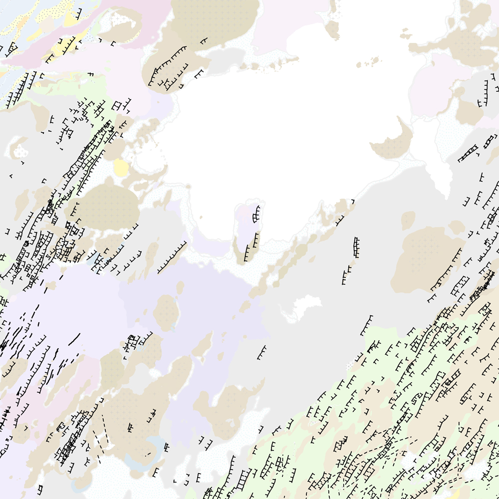
Þekja [layer] j100v_vesturgosbelti_hoggun_1utg_li: Höggun á Vesturgosbelti Íslands, línulag. [Tectonic of the Western Volcanic Zone Icelands, line features.] Gögn sýna sprungur, misgengi, gjár, mislægi og brotalínur, kortlagt í mkv. 1:100.000. [Tectonic line features such as faults, fractures, fissures, unconformity, and fracture lines mapped at 1:100,000 scale.]
-
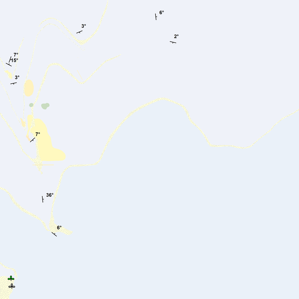
Þekja [layer] j100v_vesturgosbelti_berggrunnur_1utg_p: Steingervingar og strik og halli. [Fossils and strike and dip.] Gögnin innihalda halli, strík og hallaáttir ásamt þekktum steingervingum. Stríkstefna (fitjueigindi 'strikstefna'): 0-359° - fylgir 'right-hand rule'. Hallastefnu eru +90° frá stríksetfna. [The data includes dip, strike and dip directions along with known fossil locations. Strike direction (feature attribute 'strikstefna') follows the right-hand rule where dip direction is +90° from strike.]