 Lýsigagnagátt
ESRI ArcGIS FileGDB
Type of resources
Available actions
Topics
INSPIRE themes
Keywords
Contact for the resource
Provided by
Years
Formats
Representation types
Update frequencies
status
Scale
-
Gagnasafn (GDB) NI_reit_v_LiflandfraedilegSvaedi_sveppir: Líflandfræðileg svæði fyrir sveppi [Bio-geographical provinces for fungi in Iceland]. Reitakerfið er notað til að sýna grófa útbreiðslu sveppa eftir landshlutum og byggir á 10 km reitakerfi NÍ. Fláka- og línulag.
-
Gagnasafn (GDB) NI_reitakerfi_v: Reitakerfi fyrir útbreiðslukort lífvera á Íslandi í 10 km og 2 km reitum [10-km- and 2-km-grid to compile distribution maps of organisms in Iceland]. Flákalag og punktalag (miðpunktar). Hver reitur er auðkenndur með 4 tölustöfum þannig að tvær fyrstu tölurnar tilgreina lóðrétta dálkinn en tvær síðustu þann lárétta. [Polygons and center points. The tiles are numberd with a 4 digit code, the first 2 digits name the column, the last 2 digits name the row within this grid.]
-
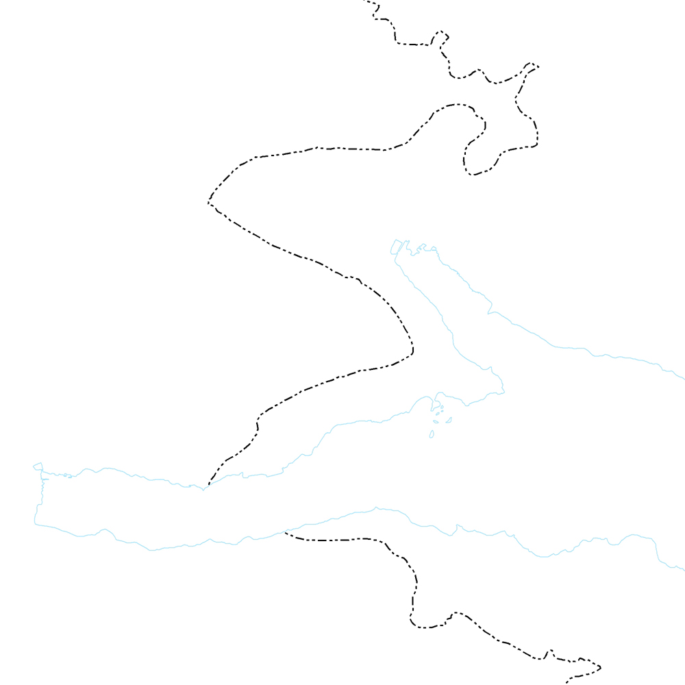
Þekja (layer) j100v_austurland_gigar_1utg_li: Útlínur öskjurima útkulnaðra megineldsstöðva. [Outlines of calderas of extinct volcanos.] Útlínur miða við höggun, dreifingu þursabergs og móbergsmyndana. [The lines are based on local tectonics, distribution of agglomerates and hyaloclastites.]
-
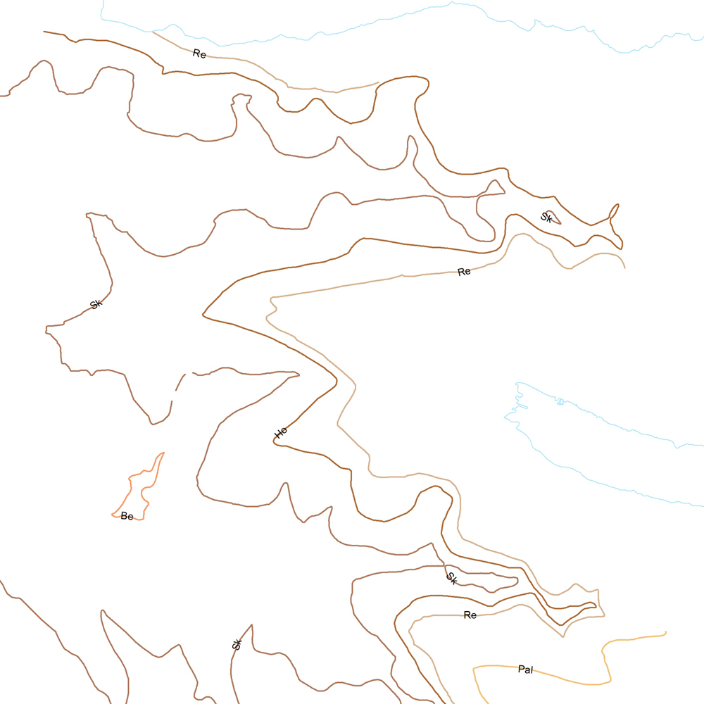
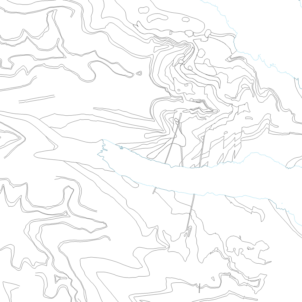
Þekja (layer) j100v_austurland_millilog_1utg_li:: Gjóskulög á Austfjörðum. [Tuff layers in Eastern Iceland.] Línur sýna staðsetningu stærstu gjóskulagana á Austfjörðum. Gjóskulögin eru fengin úr ýmsum kortum og kortlagningu Birgis V. Óskarssonar. Gögn eru flokkuð eftir ÍST120:2012 staðlinum, nema þrjá fitjueigindir: myndunKodi = Heiti myndunarinnar (skammstöfun) myndunIS = Heiti myndunarinnar (á íslenskuc) myndunEN = Heiti myndunarinnart (á ensku) [Lines show the location of largest tuff deposits in Eastern Iceland. The tuff layers are derived from older maps and the mapping of Birgir V. Óskarsson. The data follows the ÍST120:2012 data standard with the three additional feature attributes: myndunKodi = Lithostratigraphic unit (abbreviation) myndunIS = Lithostratigraphic unit (in Icelandic) myndunEN = Lithostratigraphic unit (in English)]
-
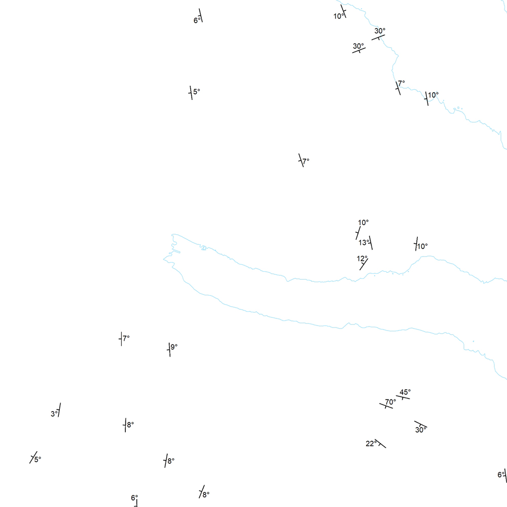
Þekja (layer) j100v_austurland_strikHalli_1utg_p: Strik og hallastefna jarðlaga. [Strike and dip of the deposits.] Staðsetning mælinga á striki og hallastefnu jarðlaga á Austurlandi. [Locations of measurements of strike and dip of the deposits in Eastern Iceland.]
-

Gagnasafn (GDB) NI_J600v_hoggun: Jarðfræðikorti af Íslandi – Höggun – 1:600.000 [Geological Map of Iceland – Tectonics – 1:600.000]. Höggunarkort af Íslandi sýnir jarðfræði landsins á nýstárlegan hátt. Jarðlög eru flokkuð eftir aldri en ekki eftir gerð og samsetningu. Sýnd eru eldstöðvakerfi, þ.e. megineldstöðvar, sprungu- og gangareinar, bæði virkar og útkulnaðar. Einnig eru sýnd helstu brotakerfi landsins og halli jarðlaga. Kortið gefur innsýn í jarðfræðilega byggingu landsins. [The Tectonic Map of Iceland gives a new view of the country's geology. The rocks are classified by age, but not by type or composition. Volcanic systems including central volcanoes, fissures and dyke swarms, both active and extinct, are shown, as are the island's principal fracture zones and the dip of rock layers. The map thus gives a useful insight into the geological structure of the country.]
-
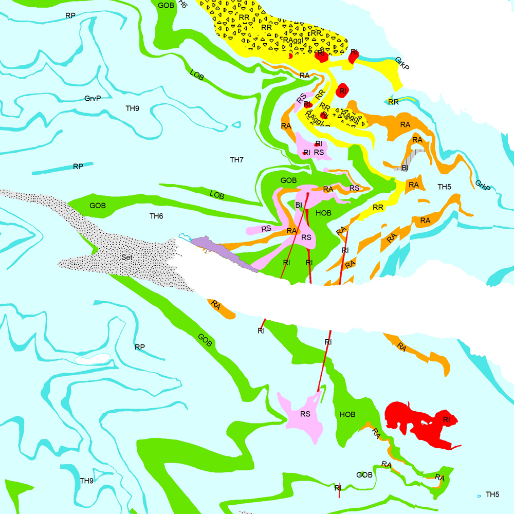
Þekja (layer) j100v_austurland_berggrunnur_1utg_fl: Gögn sem sýnir bergrunn Austurlands. [Data showing the bedrock geology of Eastern Iceland.] Flákalag með bergrunn Austurlands. Flákarnir sýna mismunandi gerðir storkubergs ásamt sethulu. Gögn eru flokkuð eftir ÍST120:2012 staðlinum, nema þrjá fitjueigindir: myndunKodi = Heiti myndunarinnar (skammstöfun) myndunIS = Heiti myndunarinnar (á íslenskuc) myndunEN = Heiti myndunarinnart (á ensku) Nýr kóði fyrir fitjueigindi 'Tegund storkubergs' (tegStorkubergs): shra = samsett hraun, dbas = Dílabasalt, dobas = Díla- og olívínbasalt, and = Andesít. [Polygone layer of the bedrock geology of Eastern Iceland. The polygones show different classes of intrusive and extrusive rocks and the sediment cover. The data follows the ÍST120:2012 data standard with the three additional feature attributes: myndunKodi = Lithostratigraphic unit (abbreviation) myndunIS = Lithostratigraphic unit (in Icelandic) myndunEN = Lithostratigraphic unit (in English) New codes for feature attribute 'Tegund storkubergs' (tegStorkubergs) are: shra = composit lava, dbas = porphyritic lava, dobas = porphyritic and olivine basalt, and = andesite.]
-
Þekja (layer) j100v_austurland_berggrunnurMork_1utg_li: Línur sýna þekkt mörk berggrunns. [Lines showing certain boundaries of bedrock.] Tilheyra flákagögn 'ni_j100v Berggrunnur á Austurlandi – 1:100.000' (j100v_austurland_berggrunnur_1utg_fl). [Follows the polygon data 'ni_j100v Berggrunnur á Austurlandi – 1:100.000' (j100v_austurland_berggrunnur_1utg_fl).]
-
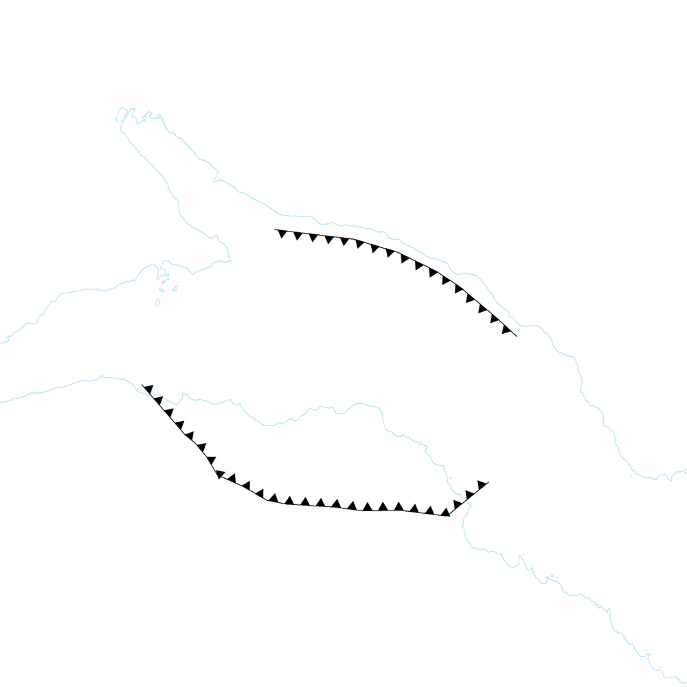
Þekja (layer) j100v_austurland_anomaliaC5n_1utg_li: Neðri mörk segulanomalíunar Chron 5. [Lower limits of magnetic anomaly Chron 5.] Útlínan fylgir efstu hraunum Grjótárólivínbasaltsyrpunnar. [The line follows the uppermost lava flows of Grjótá olivine basalt group.]
-
Þekja (layer) j100v_austurland_steingervingar_1utg_p: Fundarstaðir steingervinga. [Locations with fossils.] Fundarstaðir steingervinga, einkum plöntusteingervinga eða surtabrands. [Location with fossils, exclusvely plant fossils or lignite deposits.]