 Lýsigagnagátt
asNeeded
Type of resources
Available actions
Topics
INSPIRE themes
Keywords
Contact for the resource
Provided by
Years
Formats
Representation types
Update frequencies
status
Scale
-
EN: Lake and coastal waterbodies in Iceland. "Lake" means a body of standing inland surface water. "Coastal water" means surface water on the landward side of a line, every point of which is at a distance of one nautical mile on the seaward side from the nearest point of the baseline from which the breadth of territorial waters is measured, extending where appropriate up to the outer limit of transitional waters. For further description of dataset fields and field values see GML schema here: http://dd.eionet.europa.eu/schemas/WFD2016/GML_SurfaceWaterBody_2016.xsd IS:Stöðuvatns- og strandsjávarhlot á Íslandi. "Stöðuvatn" er kyrrstætt yfirborðsvatn. "Strandsjór" er yfirborðsvatn landmegin við línu sem dregin er einni sjómílu utan grunnlínu landhelginnar og nær inn að ytri mörkum árósavatns. Nánari lýsing á eigindum og gildum gagnasettsins má finna í GML skema hér: http://dd.eionet.europa.eu/schemas/WFD2016/GML_SurfaceWaterBody_2016.xsd
-

Riparian zones represent transitional areas occurring between land and freshwater ecosystems, characterised by distinctive hydrology, soil and biotic conditions and strongly influenced by the stream water. They provide a wide range of riparian functions (e.g. chemical filtration, flood control, bank stabilization, aquatic life and riparian wildlife support, etc.) and ecosystem services. The Riparian Zones products will support the objectives of several European legal acts and policy initiatives, such as the EU Biodiversity Strategy to 2020, the Habitats and Birds Directives and the Water Framework Directive. Land Cover/Land Use (LC/LU) classification is tailored to the needs of biodiversity monitoring in a tailored buffer zone along large and medium-sized European rivers (with Strahler levels 3-8 derived from EU-Hydro). LC/LU is extracted from VHR satellite data and other available data in a buffer zone of selected rivers. The classes follow the pre-defined nomenclature on the basis of MAES typology of ecosystems (Level 1 to Level 4) and Corine Land Cover, providing 80 distinct thematic classes with a Minimum Mapping Unit (MMU) of 0.5 ha and a Minimum Mapping Width (MMW) of 10 m. The production of the Riparian Zones products was coordinated by the European Environment Agency in the frame of the EU Copernicus programme.
-

Línurnar sýna friðunarsvæði, þar sem eldi laxfiska (fam. salmonidae) í sjókvíum er óheimilt skv. auglýsingu nr. 460/2004.
-

Akkeri og baujur og áætlaðar staðsetningar fyrir búnað í sjókvíaeldi.
-
Línurnar sýna friðunarsvæði, þar sem eldi laxfiska (fam. salmonidae) í sjókvíum er óheimilt skv. auglýsingu nr. 460/2004.
-
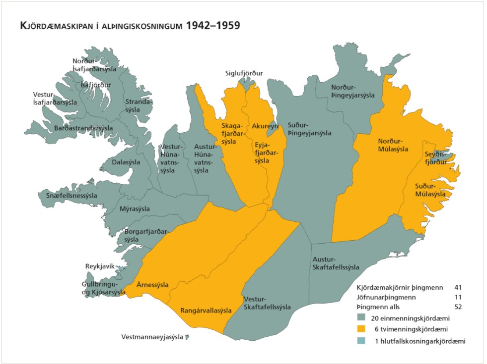
Kjördæmi eru afmörkuð landsvæði sem mynda einn af grunnþáttum kosningakerfisins. Framboðslistar eru lagðir fram fyrir hvert og eitt kjördæmi þannig að kjósendur í sama kjördæminu geta valið á milli sömu framboðslistanna og kjörnir fulltrúar hljóta þar umboð sitt til þingsetu. Kjördæmaskipulagið og fjöldi kjósenda í hverju þeirra liggur til grundvallar þegar þingsætum er úthlutað eftir þingkosningar. Þar sem kjördæmaskipulagið er ráðandi fyrir vægi atkvæða kjósenda hefur það mikil áhrif á það hvaða frambjóðendur fá sæti á þingi að loknum kosningum. Kjördæmaskipulagið er því meðal þess sem oft hefur orðið að deiluefni. Þegar gerðar voru á því verulegar breytingar kostuðu þær jafnan pólitísk átök og allar hafa þær þýtt málamiðlanir milli ólíkra sjónarmiða. Tekið af vef Alþingis: https://www.althingi.is/thingmenn/althingiskosningar/kosningar-og-kosningaurslit/kjordaemaskipulagid/
-
Gagnasafn (GDB) NI_G1v_lupina_3.utg: Útbreiðsla alaskalúpínu á Íslandi, 3. útgáfa. [Nootka lupin coverage of Iceland, 3rd edition.] Endurskoðað kortlagningu á útbreiðslu alaskalúpínu á landinu, flákalag. Alaskalúpína (Lupinus nootkatensis), sem skilgreind er sem ágeng, framandi plöntutegund hér á landi, er orðin mjög útbreidd og þekur víða stór svæði. Hún veldur miklum breytingum á náttúrufari þar sem hún breiðist um.
-

Útlínur dregnar á grundvelli háupplausnarlandlíkana sem mæld voru með leysimælitækum úr flugvél á árunum 2007 til 2013.
-
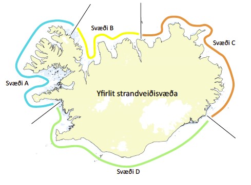
Vinsamlega hafið samband við Fiskistofu vegna nánari upplýsinga.
-
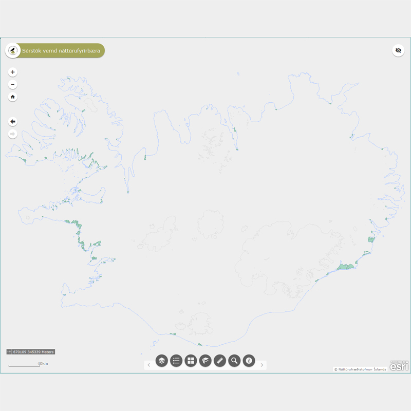
Þekja (layer) n25v_leirur_fl: Leirur á Íslandi. (Mudflats.) Leirur njóta sérstakrar verndar samkvæmt 61 gr. í lögum um náttúruvernd. Náttúrufræðistofnun Íslands heldur skrá yfir þessi náttúrufyrirbæri og birtir í kortasjá sem jafnframt er viðauki við náttúruminjaskrá.