 Lýsigagnagátt
Type of resources
Available actions
Topics
INSPIRE themes
Keywords
Contact for the resource
Provided by
Years
Formats
Representation types
Update frequencies
status
Service types
Scale
Resolution
-
Niðurhalsþjónustur fyrir INSPIRE tilskipunina og grunngerð landupplýsinga. Vefþjónn fyrir landfræðileg gögn Umhverfisstofnunar. Vefþjónnin er byggður á opnum staðli OGC og hægt er að nálgast gögnin á vefþjóninum í gegnum ýmsar tegundir þjónusta, s.s. WFS, WMS.
-

Íslenskur texti er í vinnslu. This raster dataset is a visibility analysis of several wind turbine projects across Iceland which are a part of the fifth phase of the master plan (Rammaáætlun http://www.ramma.is/). The area analysed is a 45 km buffer zone around each wind turbine project. The cutout areas in the 45 km buffer have no visibility due to visual obstruction. The red colour represents high visibility, fading into yellow, with the green colour representing low visibility of the wind turbines. Zones of theoretical visibility have been classified as near (0-2km), intermediate (2-15km) and remote zone (>15km) which are represented in the colour grading. It should be considered that atmospheric conditions, lighting, shading and more affect visibility and detectability. The perception of the wind projects in the green zone will be more fading in the landscape without direct detection, while in the red coloured zone the wind turbine is a prominent element in the landscape. For further information consider reading the respective chapter in the project report or check out further tools like the Ramma 3D map. As a digital elevation model the 10x10 m resolution ÍslandsDEM is used which sets the dataset pixel resolution to 10x10 m. An average viewer height of 1.75 m is assumed, while the wind turbine heights vary between 150 m and 200 m depending on project sites. The maximal height of the wind turbine is considered, meaning to the upper blade tip. See more information in the table on the side. The curvature of the earth is considered in the simulation and a default atmospheric refraction of 0.13 is assumed.
-
Vinsamlega hafið samband við Hafrannsóknastofnun vegna nánanri upplýsinga.
-
Niðurhalsþjónustur Orkustofnunar
-

Riparian zones represent transitional areas occurring between land and freshwater ecosystems, characterised by distinctive hydrology, soil and biotic conditions and strongly influenced by the stream water. They provide a wide range of riparian functions (e.g. chemical filtration, flood control, bank stabilization, aquatic life and riparian wildlife support, etc.) and ecosystem services. The Riparian Zones products will support the objectives of several European legal acts and policy initiatives, such as the EU Biodiversity Strategy to 2020, the Habitats and Birds Directives and the Water Framework Directive. Land Cover/Land Use (LC/LU) classification is tailored to the needs of biodiversity monitoring in a tailored buffer zone along large and medium-sized European rivers (with Strahler levels 3-8 derived from EU-Hydro). LC/LU is extracted from VHR satellite data and other available data in a buffer zone of selected rivers. The classes follow the pre-defined nomenclature on the basis of MAES typology of ecosystems (Level 1 to Level 4) and Corine Land Cover, providing 80 distinct thematic classes with a Minimum Mapping Unit (MMU) of 0.5 ha and a Minimum Mapping Width (MMW) of 10 m. The production of the Riparian Zones products was coordinated by the European Environment Agency in the frame of the EU Copernicus programme.
-

Þekja sem sýnir halla lands í gráðum byggt á landlíkani Náttúrufræðistofnunar (IslandsDEM útg. 1). Aðeins er sýndur halli á ákveðnu bili sem miðast við algengan upptakahalla snjóflóða. Litir og flokkun halla er ætluð til að hjálpa ferðafólki í fjalllendi að meta halla í brekkum með tilliti til upptakahalla snjóflóða. Þekjuna er hægt að birta sem myndkorta-flísar (XYZ, 512x512 pixlar) í Web-Mercator vörpun (EPSG:3857). Sniðmát fyrir slóðina á flísarnar eru: https://geo.vedur.is/geoserver/www/imo_slopemap_epsg3857_v1/{z}/{x}/{y}.png Skýringarmynd fyrir litakvarða er aðgengileg hér: https://geo.vedur.is/geoserver/www/imo_slopemap_epsg3857_v1/Legend_box_v1.png
-

Staðsetning íslenskra jökla ásamt nafni og GLIMS auðkenni. Útlínur dregnar eftir uppréttum Sentinel-2 og Pléiades gervihnattamyndum ásamt loftmyndum frá Loftmyndum ehf. á stöku stað. Útlínur hafa verið mældar í kringum 1890, 1945-1946, 1970-1980, 1998-2004, 2007-2013, 2014, 2017, 2019, 2021, 2023 og 2025 og öll gagnalögin er að finna í þjónustum Veðurstofnunnar.
-

Upplýsingar um sprungur sem finnast á Reykjanesskaga. Fyrir frekari upplýsingar er hægt að hafa samband við Veðurstofu Íslands
-
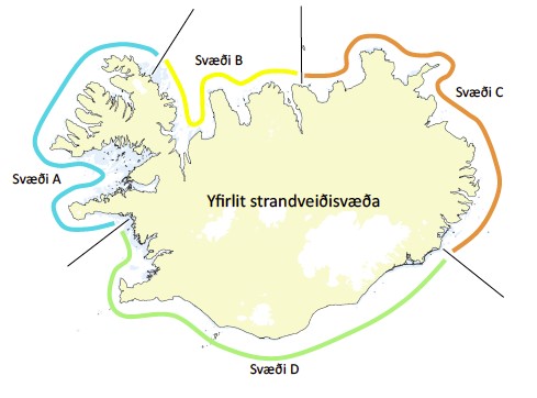
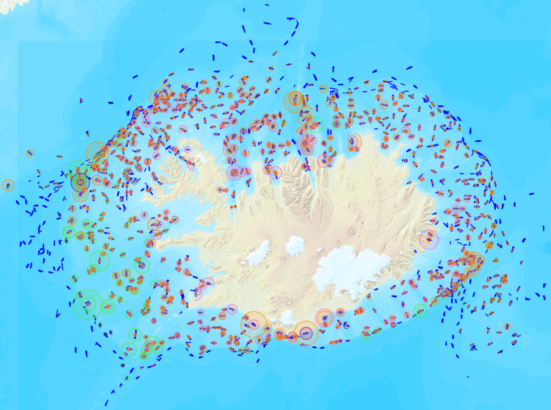
Vinsamlega hafið samband við Fiskistofu vegna nánari upplýsinga.
-
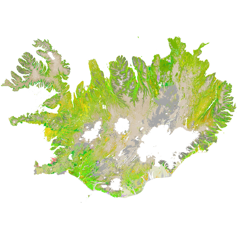
Gagnaset (data set) ni_vg25r_3utg: Vistgerðir á Íslandi: land (Habitat types of Iceland: terrestrial). Vistgerðakortið sýnir útbreiðslu landvistgerða á Íslandi. Alls hafa verið ákvarðaðar 64 vistgerðir á landi og skiptast í 12 meginflokka (vistlendi). Innan landvistgerða eru fjórar jarðhitavistgerðir sem finnast á háhita- og lághitasvæðum landsins. Landvistgerðum er skipt upp í tvö þrep. Við skilgreiningu og flokkun vistgerða á Íslandi var tekið mið af EUNIS-flokkunarkerfinu (European Environment Agency 2012) . Í 3. útgáfu vistgerðakortsins 2024 eru eingöngu landvistgerðir endurskoðaðar. Náttúrufræðistofnun Íslands leggur með ritinu Vistgerðir á Íslandi fram tillögur að flokkun vistgerða sem á sér fyrirmynd í samræmdri og viðurkenndri flokkun vistgerða í Evrópu. Flokkunin byggir á rannsóknum víða um land með fyrirvara um að bæta mætti í þá þekkingu. Athuga skal að aðgreining landvistgerða með fjarkönnun reyndist erfið, bæði fyrir lítið grónar vistgerðir sem og vel grónar, einkum innan vistlenda. Því má búast við verulegum skekkjum þótt þær séu mismiklar eftir vistgerðum. Nánari útlistun og mat á skekkjum má finna í aðferðalýsingu og á staðreyndasíðum vistgerða í ritinu „Vistgerðir á Íslandi“. Frekari upplýsingar um flokkun og skilgreiningu vistgerða má sjá í ritinu: Jón Gunnar Ottósson, Anna Sveinsdóttir og María Harðardóttir, ritstj. 2016. Vistgerðir á Íslandi. Fjölrit Náttúrufræðistofnunar nr. 54. 299 s. og á vef Náttúrufræðistofnunar.