 Lýsigagnagátt
SurfaceWaterBody IS 20181222
EN: Lake and coastal waterbodies in Iceland. "Lake" means a body of standing inland surface water. "Coastal water" means surface water on the landward side of a line, every point of which is at a distance of one nautical mile on the seaward side from the nearest point of the baseline from which the breadth of territorial waters is measured, extending where appropriate up to the outer limit of transitional waters. For further description of dataset fields and field values see GML schema here:
http://dd.eionet.europa.eu/schemas/WFD2016/GML_SurfaceWaterBody_2016.xsd
IS:Stöðuvatns- og strandsjávarhlot á Íslandi. "Stöðuvatn" er kyrrstætt yfirborðsvatn. "Strandsjór" er yfirborðsvatn landmegin við línu sem dregin er einni sjómílu utan grunnlínu landhelginnar og nær inn að ytri mörkum árósavatns. Nánari lýsing á eigindum og gildum gagnasettsins má finna í GML skema hér:
http://dd.eionet.europa.eu/schemas/WFD2016/GML_SurfaceWaterBody_2016.xsd
Simple
- Date ( Publication )
- 2018-12-22
- Status
- Completed
- Maintenance and update frequency
- As needed
- Keywords ( Theme )
-
- INSPIRE
- Surface waterbody
- Lake waterbody
- Stöðuvatnshlot
- Strandsjávarhlot
- Stjórn Vatnamála
- Priority dataset
- GSL
- Legislation Level ( Theme )
- Topic categories in accordance with EN ISO 19115 ( Theme )
-
- Inland Waters
- INSPIRE priority data set ( Theme )
- GEMET - INSPIRE themes, version 1.0 ( Theme )
- Use constraints
- Other restrictions
- Other constraints
- This work is licensed under a Creative Commons Attribution 4.0 International License (CC-BY)
- Access constraints
- Other restrictions
- Other constraints
- no limitations to public access
- Spatial representation type
- Vector
- Denominator
- 50000
- Metadata language
- en
- Character set
- UTF8
- Topic category
-
- Inland waters
))
- Reference system identifier
- http://www.opengis.net/def/crs/EPSG/0/4326
- Distribution format
-
-
GeoTIFF
(
1.0
)
-
KML
(
0
)
-
PNG
(
0
)
-
GML
(
3.2.1
)
-
ZIP
(
0
)
-
GeoTIFF
(
1.0
)
- OnLine resource
-
Eionet
(
WWW:LINK-1.0-http--link
)
Further information of data set fields and field values see GML schema
- OnLine resource
- Icelandic Met Office ( WWW:LINK-1.0-http--link )
- OnLine resource
-
Opin gögn - Stjórn vatnamála
(
WWW:LINK-1.0-http--link
)
Heimasíða með opinberum landupplýsingum sem tengjast stjórn vatnamála á Íslandi.
- OnLine resource
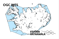
- https://dservices1.arcgis.com/s4ES6RrX27tE99NO/arcgis/services/WFS_SurfaceWaterBody_IS_20181222/WFSServer?service=wfs&request=getcapabilities ( OGC:WFS )
- OnLine resource
- WISE GIS guidance (v6.0.6 2016-04-29) ( WWW:LINK-1.0-http--related )
- OnLine resource
- Stjórn vatnamála ( WWW:LINK-1.0-http--partners )
- Hierarchy level
- Dataset
Conformance result
- Date ( Publication )
- 2010-12-08
- Explanation
- Validation has not been performed.
- Pass
- No
- Statement
- The data has been both topologically and attribute value verified and validated internally and conforms to all WISE GIS guidance requirements on the reporting of spatial data to WISE (v6.0.6). This is the current official version (2018-12-22) of the data.
gmd:MD_Metadata
- File identifier
- 5cf4a003-fb24-4471-b61f-749003a02393 XML
- Metadata language
- en
- Character set
- UTF8
- Hierarchy level
- Dataset
- Date stamp
- 2021-12-15T20:26:15
- Metadata standard name
- INSPIRE Metadata Implementing Rules
- Metadata standard version
- Technical Guidelines based on EN ISO 19115 and EN ISO 19119 (Version 1.2)
http://www.vedur.is/
Overviews
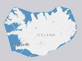
Spatial extent
Provided by
